History
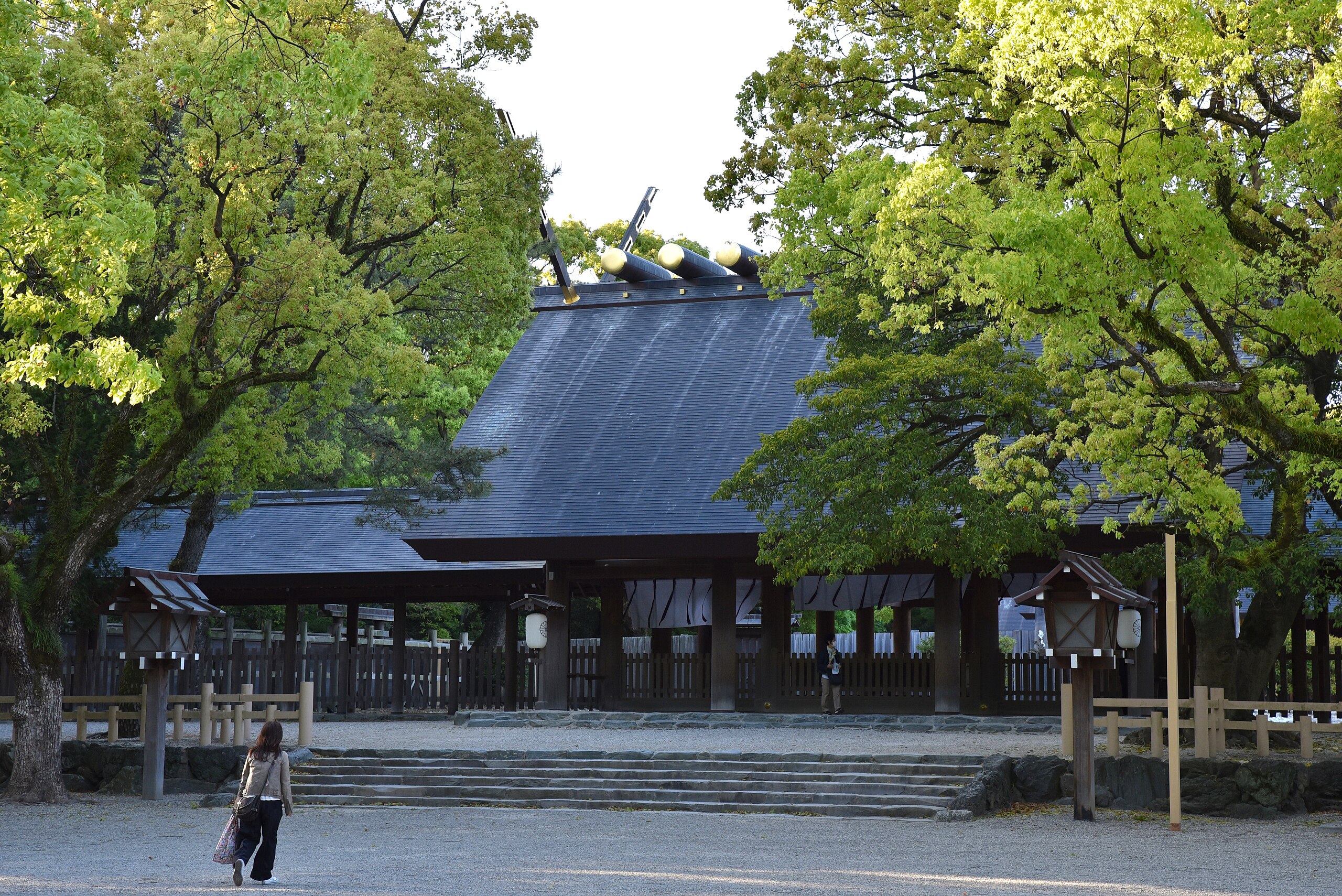
The Atsuta Shrine
Fun Fact: One of Japan's 3 Great Treasures is here! The legendary sword, Kusanagi no Tsurugi!
Early Modern Period
During this period Nagoya Castle was constructed, built partly from materials taken from Kiyosu Castle. During the construction, the entire town around Kiyosu Castle, consisting of around 60,000 people, moved from Kiyosu to the newly planned town around Nagoya Castle.[9] Around the same time, the nearby ancient Atsuta Shrine was designated as a waystation, called Miya (the Shrine), on the important Tōkaidō road, which linked the two capitals of Kyoto and Edo (now Tokyo). A town developed around the temple to support travelers. The castle and shrine towns formed the city.
Modern Period
During the Meiji Restoration Japan's provinces were restructured into prefectures and the government changed from family to bureaucratic rule. Nagoya was proclaimed a city on October 1, 1889, and designated a city on 1 September 1956, by government ordinance. Nagoya became an industrial hub for the region. Its economic sphere included the famous pottery towns of Tokoname, Tajimi and Seto, as well as Okazaki, one of the only places where gunpowder was produced under the shogunate. Other industries included cotton and complex mechanical dolls called karakuri ningyō.
Mitsubishi Aircraft Company was established in 1920 in Nagoya and became one of the largest aircraft manufacturers in Japan. The availability of space and the central location of the region and the well-established connectivity were some of the major factors that lead to the establishment of the aviation industry there.
Geography
Map
The Purple part is Nagoya
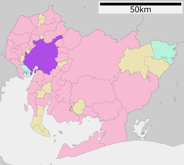
Nagoya is in what can be stated as the center of japan. Which allowed it to develop economically and politically
Nagoya lies north of Ise Bay on the Nōbi Plain. Nagoya was built on low-level plateaus to ward off floodwaters. The plain is one of the nation's most fertile areas. The Kiso River flows to the west along the city border, and the Shōnai River comes from the northeast and turns south towards the bay at Nishi Ward.
The human-made Hori River was constructed as a canal in 1610. It flows from north to south, as part of the Shōnai River system. The rivers allowed for trade with the hinterland. The Tempaku River feeds from a number of smaller river in the east, flows briefly south at Nonami and then west at Ōdaka into the bay.
Climate
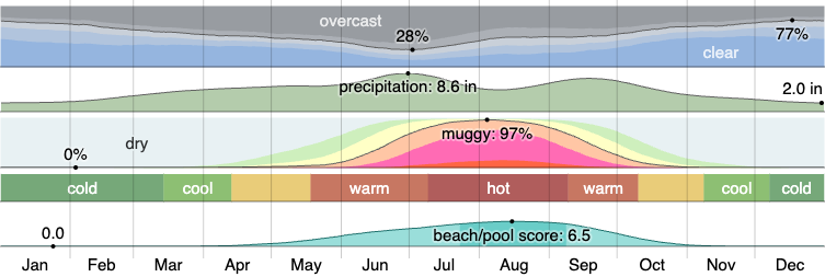
It's pretty Wet.
Nagoya has a humid subtropical climate (Köppen climate classification: Cfa) with hot, humid summers and cool winters. The summer is noticeably wetter than the winter, with rain falling throughout the year.